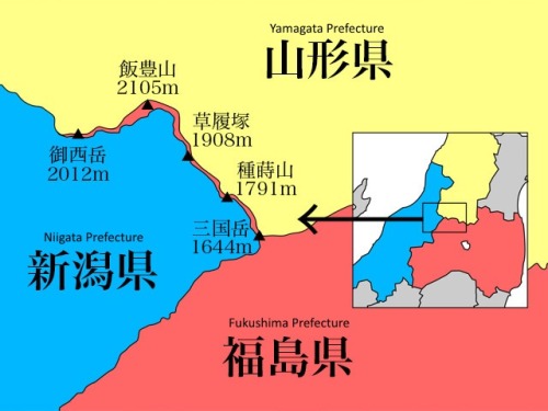
mapsontheweb:A strange strip of Fukushima Prefecture, Japan. The narrow strip of Fukushima prefect
mapsontheweb: A strange strip of Fukushima Prefecture, Japan. The narrow strip of Fukushima prefecture runs along the peak of a mountain range, ending at the Iidesan Shrine. Prefecture lines at this location were originally drawn along geographic features, so Niigata and Yamagata were split by the mountain range. This was met with resistance from Fukushima, as they claimed the Iidesan shrine was an important part of the local faith of the people of Fukushima. So the shrine and the mountain path leading to it along the peak was given to Fukushima. The strip of land is about 7km in length and only a few meters wide at some points. More border maps >>--source link
Tumblr Blog : mapsontheweb.zoom-maps.com


