Whin Sill When molten rock is rising up from the depths of the Earth towards the surface it often fr
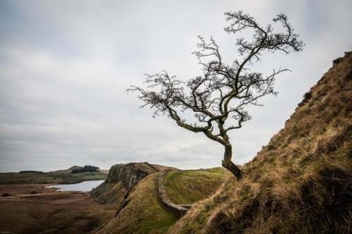
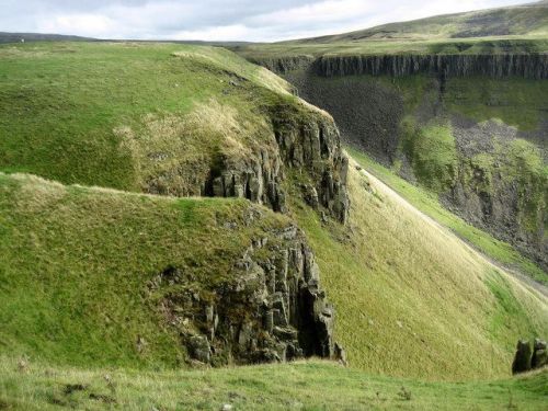
Whin SillWhen molten rock is rising up from the depths of the Earth towards the surface it often freezes or gets diverted along the way, forming blobs of granite, dykes (vertical structures often following faults in the crust, see http://on.fb.me/1XrGhpF) or sills (horizontal structures, often inserted into the bedding planes between different types of sedimentary rocks, in this case between limestone and a sandstone shale succession). The Whin is one of Britain’s iconic sills, and provided the geological backdrop to one of the Isles’ oldest surviving monuments, showing how our beautiful area of study influences human settlement patterns, boundaries and defence.The sill is made of dolerite (aka diabase to our friends across the pond), which has the same composition as a basalt, but displays larger crystals since it cooled slowly under an earthy blanket rather than quickly on the brutal contact with the chilly surface air (some 1,200 degrees Celsius less than basaltic lava). There were several pulses of magma, and the two main ones each formed a distinct subsill. The name Whin comes from an old local mining term for dark hard rocks.It intruded into 330 million year old marine sediments some 295 million years back, during the late Carboniferous, in a period of crustal extension. The magma was born as the crust thinned above the mantle, and the released pressure lowered the melting point of the rocks, generating melts (a process known as adiabatic or decompression melting).It became the border between the Roman world and that of the barbarians beyond, and in 122CE the emperor Hadrian started building a defensive wall (visible in the first photo) to keep the Caledonian tribes out and control the interaction between Roman citizens and subjects and the ‘free’ peoples on the other side. A line of forts and towns developed along the back of the tilted sill that presented a beautiful cliff face to any potential disturbers of the Pax Romana in Britannia. Several other later fortresses take advantage of the sill’s defensive cliff, including Bamburgh and Lindisfarne castles.Nowadays, the several day walk along its 120km length from Newcastle to North Wales is one of the country’s great delights, and there are many old Roman places to visit, from an isolated Mithraeum and Roman common toilet to the old fort town of Vindolanda, whose waterlogged letters provided such a beautiful insight into daily life for the garrison.LozImage credit: 1 Guardian Witness 2: Chris Heaton/geograph.org.ukhttp://bit.ly/1MMzdwuhttp://bit.ly/1kF4VoLhttp://bit.ly/1GAtooSA geological cross section: http://bit.ly/1i65PJ3http://bit.ly/1LVc2Uihttp://bit.ly/1i66j1ODolerite: http://bit.ly/1GAuWPQ -- source link
Tumblr Blog : the-earth-story.com
#geology#volcano#igneous#whin sill#diabase#dolerite

