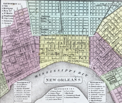
This 1850 map of Louisiana shows canals, roads, and steamboat routes. It includes the distance of st
This 1850 map of Louisiana shows canals, roads, and steamboat routes. It includes the distance of steamboat routes from New Orleans to Pittsburgh, Natchitoches, and Balize. (Balize is a historical town that was located at the mouth of the Mississippi River until the 1850s when residents began to move upriver to a settlement called Pilottown, which was near modern-day Venice).The map was hand colored to show the borders of each parish and the neighborhoods of New Orleans.Images from:A new map of Louisiana… Philadelphia : Published by Thomas, Cowperthwait & Co., 1850.Call number: G3200 DRAWER 1 MAP 40Catalog record: https://bit.ly/3Dw1I2T -- source link
Tumblr Blog : noelcollection.tumblr.com
#louisiana maps#new orleans#louisiana#antique maps#antiquarian maps#rare maps


