vampireapologist:vampireapologist:pipcomix:kyraneko:systlin:life-interrupts-the-fandoms:systlin:felr
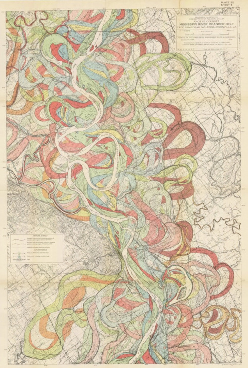
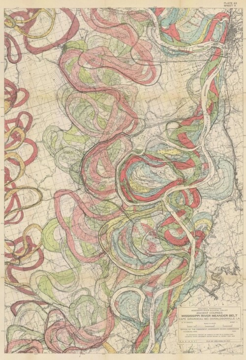
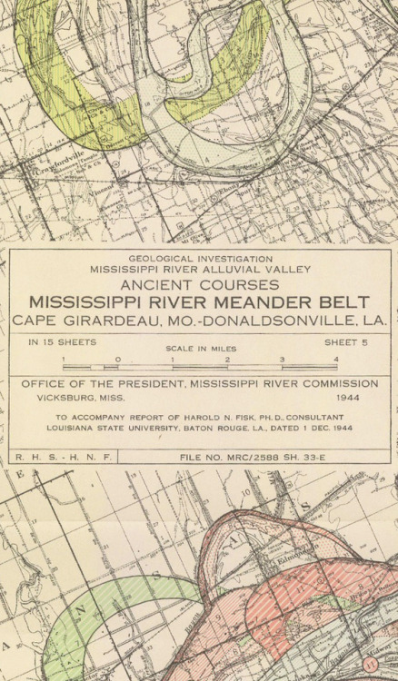
vampireapologist:vampireapologist:pipcomix:kyraneko:systlin:life-interrupts-the-fandoms:systlin:felren13:design-is-fine:Harold Fisk, maps of the Mississippi, 1944. From Southern Illionis to Southern Louisiana. Via radicalcartography.net@systlinThis is? So cool????I knew this was a thing, like mapping water paths and what not, but the amount is insane. And freaking beautiful. I want.People always seem to think of rivers as a static thing, because you see maps from overhead and in human life spans they seem to stay put. But they’re not. They’re alive. They snake back and forth, and change from one bed to another, erode a bank there and jump back to a path they haven’t used in a thousand years, they overflow and run low, and despite all our struggling we can’t always keep the river from doing what the river wants. It’s beautiful. Go home, Mississippi, you’re drunk.MEANDER BELTMeandering is so important because as rivers “move,” they deposit sediment in different places, building or enriching land. Now that the Misississippi is much more controlled by locks and dams, it (and most other major rivers) meanders a lot less, and land that relied on its cycle of sediment deposits is shrinking because the sediment gets held up other places. This is one of the major reasons the land at its delta (New Orleans) is disappearing and why storms and floods in those areas are so much more devastating. However, a lot of those lock and dam systems are put in place to prevent flooding and devastation further upstream, so it becomes a question of who are we prioritizing…I reblogged this…at the tail end of a nap and I dont remember typing it wtf why am I so passionate about river deltas in my sleep -- source link
Tumblr Blog : www.design-is-fine.org


