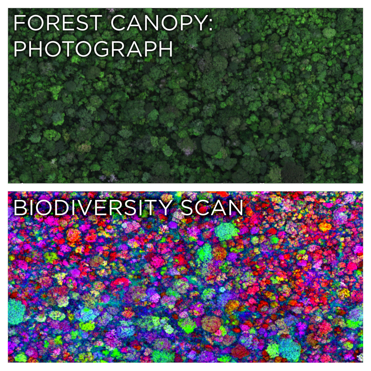
skunkbear:The top image is a photograph of a lush rainforest canopy. The bottom image colors each tr
skunkbear:The top image is a photograph of a lush rainforest canopy. The bottom image colors each tree based on its species.How? It’s all thanks to a special lab built by ecologist Greg Asner inside a twin-turboprop airplane. From a few thousand feet up, the Carnegie Airborne Observatory uses lasers, spectrometers and other instruments to build a detailed 3-D model of a forest, identify different species of vegetation and quantify carbon sequestration. It’s a lot quicker than tramping through the jungle and taking these measurements on foot.A fun tidbit from the full story:“On one occasion, he and his team mapped more than 6,500 square miles of the Colombian Amazon at night — about the size of Connecticut plus Rhode Island — flying with all their lights out to avoid being shot at by the FARC, the Colombian rebel force.”Images: Greg Asner, Carnegie Airborne Observatoryoh gosh, does this only work with known species? Like, will an unidentified tree show up a different color or will it show up as a blank space, a 404 error: tree unknown? Either way, if they did scan a new tree, would it be geocached so they could go back and find it again?? -- source link
Tumblr Blog : skunkbear.tumblr.com
#trees#rain forests#forestry
