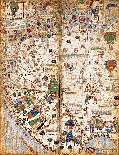
frenchhistory:Atlas catalan, 1375 Manuscrit sur parchemin velin. 6 pl. collées sur des ais de bois,
frenchhistory:Atlas catalan, 1375 Manuscrit sur parchemin velin. 6 pl. collées sur des ais de bois, dont 4 de cartes, Pl n° 3, 64 x 50 cm.Bibliothèque nationale de France, Manuscrits, espagnol 30.@creditsThe Catalan Atlas is the most important Catalan map of the medieval period (drawn and written in 1375). It was produced by the Majorcan cartographic school and is attributed to Cresques Abraham (also known as “Abraham Cresques”), a Jewish book illuminator who was self-described as being a master of the maps of the world as well as compasses. It has been in the royal library of France (now the Bibliothèque nationale de France) since the time of King Charles V. The Catalan Atlas originally consisted of six vellum leaves folded down the middle, painted in various colors including gold and silver. The leaves are now cut in half. Each half-leaf is mounted on one side of five wooden panels. The first half of the first leaf and the second half of the last leaf are mounted on the inner boards of a brown leather binding. Each measures approximately 65 × 50 cm. The overall size is therefore 65 × 300 cm. -- source link
Tumblr Blog : frenchhistory.tumblr.com
