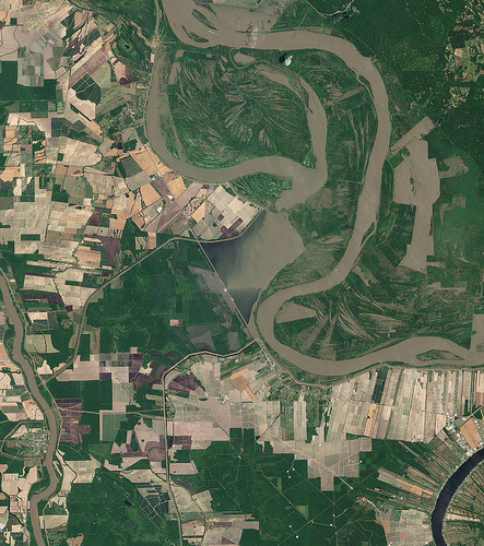
This true colour image of the Morganza Spillway located 45 miles northwest of Baton Rouge, Louisiana
This true colour image of the Morganza Spillway located 45 miles northwest of Baton Rouge, Louisiana, was captured by the Advanced Land Imager (ALI) instrument on NASA’s Earth Observing (EO-1) satellite on May 15, 2011.According to ENN.com, the U.S. Army Corps of Engineers opened up two of the 125 floodgates on May 14, and two more floodgates on May 15 to relieve the floodwaters on the Mississippi River (located to the far right). The spillway channels water from the Mississippi into the Atchafalaya River basin and will alleviate flooding in New Orleans and Baton Rouge, but flood homes, farms, a wildlife refuge and a small oil refinery. (more)Image Credit: NASA Earth Observatory/EO-1 Team, Text: NASA/Rob Gutro -- source link
Tumblr Blog : uniformitarianism.tumblr.com
#satellite#mississippi river#louisiana#aerial#morganza spillway#information
