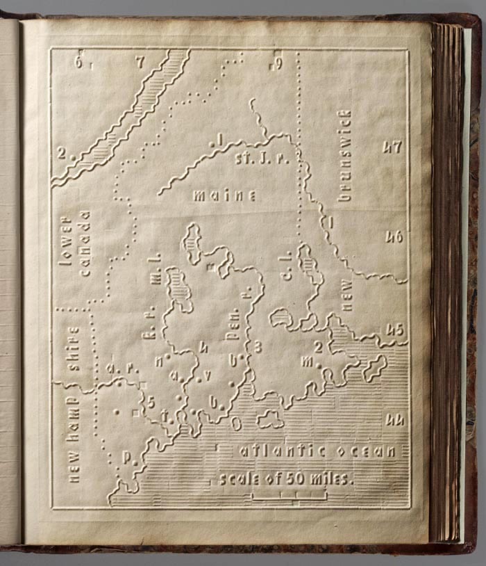
The Atlas of the United States Printed for the Use of the Blind was published in 1837 for children a
The Atlas of the United States Printed for the Use of the Blind was published in 1837 for children at the New England Institute for the Education of the Blind in Boston. Without a drop of ink in the book, the text and maps in this extraordinary atlas were embossed heavy paper with letters, lines, and symbols. This is the first atlas produced for the blind to read without the assistance of a sighted person that I have been able to find. Braille was invented by 1825, but was not widely used until much later. It represents letters well, but could not represent shapes and cartographic features.Samuel Gridley Howe (1801-1876) was the founder and president of the New England Institute the Education of the Blind (later known as the Perkins Institute) and produced the atlas. Previous maps for the blind had been made, but as Howe wrote with frustration in the introduction to his atlas, they all required a sighted person to help the blind reader. Fifty copies of his atlas were made and five survive today, including this one. The atlas includes twenty-four state maps with a page of text describing each state and the symbols used on the maps. The picture shown here is of Maine, with dotted lines for the borders with Canada and New Hampshire. -- source link
Tumblr Blog : historical-nonfiction.tumblr.com
#history#blind#disabled#cartography#perkins institute#american history
