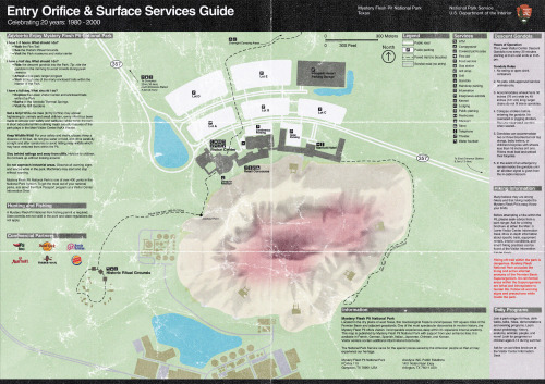
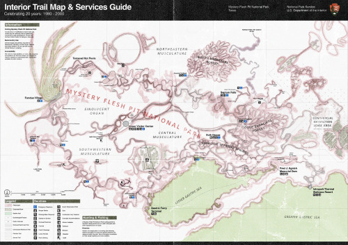
The first Mystery Flesh Pit National Park Trail Map was published in 1981 and was the first mapping
The first Mystery Flesh Pit National Park Trail Map was published in 1981 and was the first mapping of the superorganism to conform to the NPS graphic standards. Early trail maps were compiled from hundreds of individual surveys and measurements by spelunkers, explorers and eventually park engineers to form a more comprehensive picture of the Mystery Flesh Pit’s internal anatomy. With the addition of lighted and air-conditioned reinforced tunnels in the late 1970s, the park became more accessible to visitors than ever, necessitating the need for a concise, easy-to-read map familiar to any National Park visitor.The edition shown here is scan is from 2000 and commemorates the 20th anniversary of the park’s absorption into the National Park System. Notable additions to this map over older prints are the Hilton Intrapark Thermal Wellness Resort, as well as re-drawn property lines of commercial extraction areas. The monorail line is notably missing from this map, as its development would not be announced to the public until May of 2001, only to finally open after dozens of delays in the autumn of 2006. -- source link
Tumblr Blog : www.mysteryfleshpitnationalpark.com
#worldbuilding#cosmic horror#horror worldbuilding#cartography#fictionalmaps#national park#found object#unreality#worldbuilding art

